
Buckinghamshire Council’s Register of Common Land pertaining to Brill
View the Register (June 1968 to 1989) (pdf opens in new tab)
View a 2023 map of the central part of Brill Common (pdf opens in new tab)
We are sorry that the Register of Common Land document and the map are in pdf form.
If you find these hard to read, please contact the Parish Council and ask the Clerk to show you a paper version.
Contemporary maps accompanying the Register of Common Land
(common land is outlined in green)
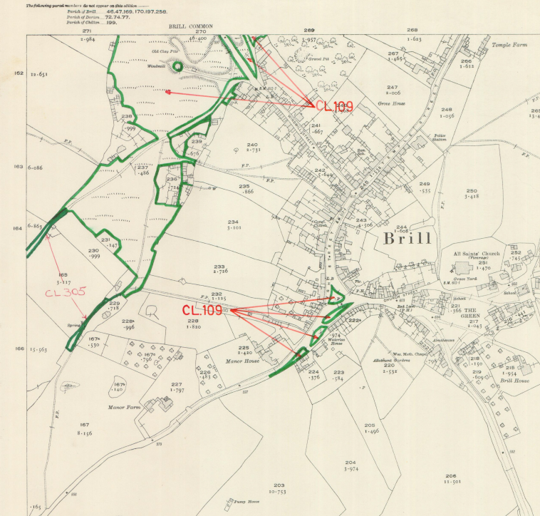
South Hills and The Square, Brill

North Hills, Tram Hill & Wotton Road

Span Green (running south-west off Touchbridge) & Hector’s Lane (linking Span Green with Oakley Road, along the foot of the map)
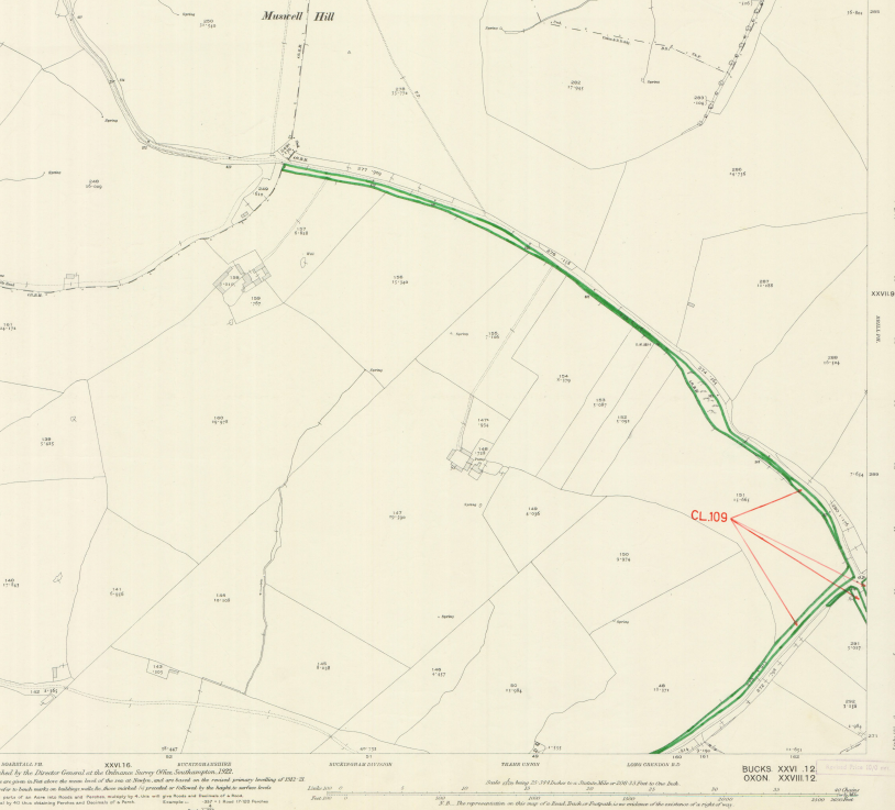
The narrow strip of common land alongside the road to Muswell Hill, NW of Brill Village